![]()
![]()
白鳥&つくばグルメポタ ![]()
2012/02/05 09:02 - 15:25 / Japan 茨城県
![]()
| Total distance: | 52.6 | km | Trip time: | 6:22'39 | Average speed: | 12.2 | km/h | |
|---|---|---|---|---|---|---|---|---|
| Ascending altitude: | 170 | m | Descending altitude: | 197 | m | Total calories: | 624 | kcal |


白鳥&つくばグルメポタ
- Japan・茨城県 2012/02/05 09:02 - 15:25
-
[Trip time] 6:22'39
[Total distance] 52.6km
[Average speed] 12.2km/h [Ascending altitude] 170m [Descending altitude] 197m
[Total calories] 624kcal
[Tags] Bicycle, Road bike
集合: 守谷駅 中央西口ロータリー 9:00コース: 守谷〜菅生沼(白鳥見物)〜つくば〜Hi-5〜つくばポタ〜みらい平駅
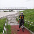
菅生沼
東郷製菓
だんごのたかの つくば店
国土地理院 地図と測量の科学館
アメリカンハンバーグ
ハイファイブ バーガーズ
パン工房 クーロンヌ つくば店
http://www.couronne.co.jp/prg_03.php


-
- ORBEA ONIX 2009
- View other bikes
kata0320
(
Male /
Japan )
0
3

 arachi
GPX export
Are you sure you want to export GPX data for this trip?
![]()
![]()