![]()
![]()
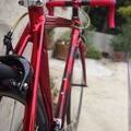
美山サイクルグリーンツアー ![]()
2016/07/31 07:08 - 15:05 / Japan 京都府南丹市
![]()
| Total distance: | 121.32 | km | Trip time: | 7:56'59 | Average speed: | 21.1 | km/h | |
|---|---|---|---|---|---|---|---|---|
| Ascending altitude: | 1525 | m | Elapsed time: | 5:38'29 | Total calories: | 1175 | kcal |
| Split time | 00:01’08 | |
|---|---|---|
| Lap time | 00:01’08 | |
| Trip lap distance | 10.11 | km |
| Average | Maximum | |||
|---|---|---|---|---|
| Lap speed | 10.3 | km/h | 25 | km/h |
| Lap heart rate | 138.5 | bpm | 163 | bpm |
| Lap cadence | 50.1 | rpm | 87.5 | rpm |
美山サイクルグリーンツアー
- Japan・京都府南丹市 2016/07/31 07:08 - 15:05
-
[Trip time] 7:56'59
[Total distance] 121.32km
[Average speed] 21.1km/h [Ascending altitude] 1525m [Total calories] 1175kcal
[Tags]
初めて自転車のイベントに参加しました。キツかったけど楽しかったです
登登路
(
Japan )
0
0

 yoshiki

GPX export
Are you sure you want to export GPX data for this trip?
![]()
![]()