![]()
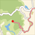
田んぼ道と山道 ![]()
2012/07/22 15:30 - 16:29 / Japan 京都南部
![]()
| Total distance: | 15.61 | km | Trip time: | 0:59'23 | Average speed: | 15.8 | km/h | |
|---|---|---|---|---|---|---|---|---|
| Ascending altitude: | 226 | m | Descending altitude: | 224 | m | Total calories: | 233 | kcal |
田んぼ道と山道
- Japan・京都南部 2012/07/22 15:30 - 16:29
-
[Trip time] 0:59'23
[Total distance] 15.61km
[Average speed] 15.8km/h [Ascending altitude] 226m [Descending altitude] 224m
[Total calories] 233kcal
[Tags] MTB, Recreation
夏の自転車乗りは暑いが、山道は日影が多いので意外と楽!


-
- Cannondale Lefty
- View other bikes


 kyon1203