![]()
2017タンデムフォンド軽井沢 ![]()
2017/05/13 09:46 - 12:44 / Japan 長野県北佐久郡軽井沢町
![]()
| Total distance: | 28.8 | km | Trip time: | 2:57'38 | Average speed: | 11.7 | km/h | |
|---|---|---|---|---|---|---|---|---|
| Ascending altitude: | 243 | m | Descending altitude: | 244 | m | Total calories: | 290 | kcal |
2017タンデムフォンド軽井沢
- Japan・長野県北佐久郡軽井沢町 2017/05/13 09:46 - 12:44
-
[Trip time] 2:57'38
[Total distance] 28.8km
[Average speed] 11.7km/h [Ascending altitude] 243m [Descending altitude] 244m
[Total calories] 290kcal
[Tags] Touring bike, Recreation, Plateau
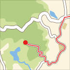
奥さんとグランフォンド軽井沢のタンデムフォンドに参加。あいにくの雨模様でしたが、奥さんが頑張って付き合ってくれました。感謝です。案外、車が多く通るコースで疲れました。

MRK
(
Male /
Japan )
サイクルレーシングチームMRK、リーダーMです。 サイクリングとお菓子が大好きです(笑)。


 もい
もい