![]()
![]()
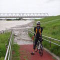
巾着田 曼珠沙華(往路) ![]()
2012/09/29 07:39 - 11:21 / Japan 埼玉県日高市
![]()
| Total distance: | 60.17 | km | Trip time: | 3:41'59 | Average speed: | 19.6 | km/h | |
|---|---|---|---|---|---|---|---|---|
| Ascending altitude: | 104 | m | Descending altitude: | 26 | m | Total calories: | 890 | kcal |


巾着田 曼珠沙華(往路)
- Japan・埼玉県日高市 2012/09/29 07:39 - 11:21
-
[Trip time] 3:41'59
[Total distance] 60.17km
[Average speed] 19.6km/h [Ascending altitude] 104m [Descending altitude] 26m
[Total calories] 890kcal
[Tags] Bicycle, Road bike
丸和だんご 川野屋 二塚店
http://tabelog.com/saitama/A1103/A110303/11005466/
巾着田
http://www.kinchakuda.com/


-
- ORBEA ONIX 2009
- View other bikes
kata0320
(
Male /
Japan )
0
0

 e-ma
e-maGPX export
Are you sure you want to export GPX data for this trip?
![]()
![]()