![]()
![]()
大阪まちあるき(真田幸村ゆかりの地) ![]()
2011/07/02 14:29 - 17:31 / Japan 大阪市内
![]()
| Total distance: | 34.99 | km | Trip time: | 3:01'37 | Average speed: | 13.7 | km/h | |
|---|---|---|---|---|---|---|---|---|
| Ascending altitude: | 193 | m | Descending altitude: | 199 | m | Total calories: | 436 | kcal |


大阪まちあるき(真田幸村ゆかりの地)
- Japan・大阪市内 2011/07/02 14:29 - 17:31
-
[Trip time] 3:01'37
[Total distance] 34.99km
[Average speed] 13.7km/h [Ascending altitude] 193m [Descending altitude] 199m
[Total calories] 436kcal
[Tags] Road bike, Recreation
大阪まちあるきの真田幸村縁の地を訪ねるコースです。http://www.osaka-info.jp/machiaruki/sanada/index.html


-
- BMC
BMC SLX-01のカンパのアテナ仕様。ペダルはクランクブラザーズです。阪神タイガースカラーでまとめております。
View other bikes
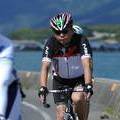
Koichi
(
Male /
Japan )
0
5

 はばたん
はばたんGPX export
Are you sure you want to export GPX data for this trip?
![]()
![]()