![]()
![]()
風返峠→湯袋峠→つつじが丘 ![]()
2013/06/18 17:58 - 19:08 / Japan つくば山
![]()
| Total distance: | 23.34 | km | Trip time: | 1:10'38 | Average speed: | 19.8 | km/h | |
|---|---|---|---|---|---|---|---|---|
| Ascending altitude: | 723 | m | Elapsed time: | 1:10'36 | Total calories: | 667 | kcal |
| Split time | 00:01’08 | |
|---|---|---|
| Lap time | 00:01’08 | |
| Trip lap distance | 10.11 | km |
| Average | Maximum | |||
|---|---|---|---|---|
| Lap speed | 10.3 | km/h | 25 | km/h |
| Lap heart rate | 138.5 | bpm | 163 | bpm |
| Lap cadence | 50.1 | rpm | 87.5 | rpm |
風返峠→湯袋峠→つつじが丘
- Japan・つくば山 2013/06/18 17:58 - 19:08
-
[Trip time] 1:10'38
[Total distance] 23.34km
[Average speed] 19.8km/h [Ascending altitude] 723m [Total calories] 667kcal
[Tags] Road bike, Hill climb, Cloudy
りんりんロードつくば駅駐車場に車を止め、軽く山登りしてきました。
今週末にツール・ド・つくばが開催されるとあって、結構遅い時間にもかかわらず、何人かのロード乗りの方にあいました。


-
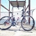
- DE ROSA R848
- View other bikes
ひぃ
(
Male /
Japan )
0
1

 ronhao
GPX export
Are you sure you want to export GPX data for this trip?
![]()
![]()