![]()
![]()
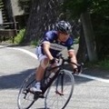
小沢峠経由有馬ダム(名栗湖) ![]()
2014/10/29 11:59 - 16:40 / Japan 青梅・飯能
![]()
| Total distance: | 78.73 | km | Trip time: | 4:41'47 | Average speed: | 22.4 | km/h | |
|---|---|---|---|---|---|---|---|---|
| Ascending altitude: | 1365 | m | Elapsed time: | 3:26'49 | Total calories: | 1306 | kcal |
| Split time | 00:01’08 | |
|---|---|---|
| Lap time | 00:01’08 | |
| Trip lap distance | 10.11 | km |
| Average | Maximum | |||
|---|---|---|---|---|
| Lap speed | 10.3 | km/h | 25 | km/h |
| Lap heart rate | 138.5 | bpm | 163 | bpm |
| Lap cadence | 50.1 | rpm | 87.5 | rpm |
小沢峠経由有馬ダム(名栗湖)
- Japan・青梅・飯能 2014/10/29 11:59 - 16:40
-
[Trip time] 4:41'47
[Total distance] 78.73km
[Average speed] 22.4km/h [Ascending altitude] 1365m [Total calories] 1306kcal
[Tags] Bicycle, Road bike


-
- RIS9
- View other bikes
sugit
(
Male /
Japan )
回した分だけ強くなる!
0
0

 mukkey
GPX export
Are you sure you want to export GPX data for this trip?
![]()
![]()