![]()
帰り道 ![]()
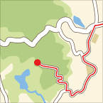
2013/06/23 12:04 - 13:44 / Japan 刈谷ハイウェイオアシス
![]()
| Total distance: | 20.66 | km | Trip time: | 1:39'39 | Average speed: | 17.1 | km/h | |
|---|---|---|---|---|---|---|---|---|
| Ascending altitude: | 54 | m | Descending altitude: | 101 | m | Total calories: | 296 | kcal |
帰り道
- Japan・刈谷ハイウェイオアシス 2013/06/23 12:04 - 13:44
-
[Trip time] 1:39'39
[Total distance] 20.66km
[Average speed] 17.1km/h [Ascending altitude] 54m [Descending altitude] 101m
[Total calories] 296kcal
[Tags] Road bike, Recreation, Summer
定光寺からの帰り道です。みよし市内で補給の後、刈谷ハイウェイオアシスで足湯につかり、逢妻川サイクリングロードで帰宅しました。
逢妻川サイクリングロードは全長2Km足らずですが、この近辺では信号なしの貴重な道です。


-
- 玄武弐号
フレーム:TNI 7005Mk2(M) コンポーネント:105(BBとカセットスプロケットのみアルテグラ) ホイール:WH6700 タイヤ:IRCロードライト 通販でかき集めたパーツで、自力で組みました(といいつつも、3月に1度クラッシュして、修理のついでにショップで調整しなおしてもらっていますが) オーストリッチのハンドルバッグを装備し、ツーリング指向に仕立てています。バッグの中には工具一式に予備のタイヤを2本。さらに一泊分の着替えを搭載できるスペースを確保しています。 INOUもいい位置にセットできました。 シートチューブには輪行バッグを常設。バーテープはfizikのPerformance。ちょっと厚めで気になっていたロングライド時の痺れも緩和されそうです。 これならどこまでも行けそうな気がします。
View other bikes

Nmakoto
(
Male /
Japan )


 Star Garnet