![]()
![]()
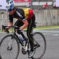
赤城ヒルクライム試走 ![]()
2013/06/23 08:34 - 16:21 / Japan 赤城山
![]()
| Total distance: | 92.91 | km | Trip time: | 7:47'57 | Average speed: | 16.8 | km/h | |
|---|---|---|---|---|---|---|---|---|
| Ascending altitude: | 2026 | m | Elapsed time: | 5:29'10 | Total calories: | 2584 | kcal |
| Split time | 00:01’08 | |
|---|---|---|
| Lap time | 00:01’08 | |
| Trip lap distance | 10.11 | km |
| Average | Maximum | |||
|---|---|---|---|---|
| Lap speed | 10.3 | km/h | 25 | km/h |
| Lap heart rate | 138.5 | bpm | 163 | bpm |
| Lap cadence | 50.1 | rpm | 87.5 | rpm |
赤城ヒルクライム試走
- Japan・赤城山 2013/06/23 08:34 - 16:21
-
[Trip time] 7:47'57
[Total distance] 92.91km
[Average speed] 16.8km/h [Ascending altitude] 2026m [Total calories] 2584kcal
[Tags] Road bike, Training, Hill climb


-
- BMC SLX01
- View other bikes
ナツメグ
(
Male /
Japan )
0
0

 ヨシクマ
ヨシクマGPX export
Are you sure you want to export GPX data for this trip?
![]()
![]()