![]()
![]()
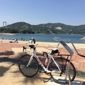
登坂ライド!!! ![]()
2014/11/02 08:21 - 16:44 / Japan 岐阜県、三重県
![]()
| Total distance: | 101.96 | km | Trip time: | 8:23'12 | Average speed: | 20 | km/h | |
|---|---|---|---|---|---|---|---|---|
| Ascending altitude: | 2137 | m | Elapsed time: | 4:48'17 | Total calories: | 1341 | kcal |
| Split time | 00:01’08 | |
|---|---|---|
| Lap time | 00:01’08 | |
| Trip lap distance | 10.11 | km |
| Average | Maximum | |||
|---|---|---|---|---|
| Lap speed | 10.3 | km/h | 25 | km/h |
| Lap heart rate | 138.5 | bpm | 163 | bpm |
| Lap cadence | 50.1 | rpm | 87.5 | rpm |
登坂ライド!!!
- Japan・岐阜県、三重県 2014/11/02 08:21 - 16:44
-
[Trip time] 8:23'12
[Total distance] 101.96km
[Average speed] 20km/h [Ascending altitude] 2137m [Total calories] 1341kcal
[Tags] Road bike


-
- メルクス
- View other bikes
大輝
(
Male /
Japan )
0
0

 kego
kegoGPX export
Are you sure you want to export GPX data for this trip?
![]()
![]()