![]()
![]()
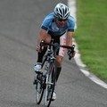
高野山 ![]()
2014/11/30 13:10 - 17:09 / Japan 和歌山県
![]()
| Total distance: | 63.54 | km | Trip time: | 3:59'21 | Average speed: | 18.6 | km/h | |
|---|---|---|---|---|---|---|---|---|
| Ascending altitude: | 1689 | m | Elapsed time: | 3:19'39 | Total calories: | 1183 | kcal |
| Split time | 00:01’08 | |
|---|---|---|
| Lap time | 00:01’08 | |
| Trip lap distance | 10.11 | km |
| Average | Maximum | |||
|---|---|---|---|---|
| Lap speed | 10.3 | km/h | 25 | km/h |
| Lap heart rate | 138.5 | bpm | 163 | bpm |
| Lap cadence | 50.1 | rpm | 87.5 | rpm |
高野山
- Japan・和歌山県 2014/11/30 13:10 - 17:09
-
[Trip time] 3:59'21
[Total distance] 63.54km
[Average speed] 18.6km/h [Ascending altitude] 1689m [Total calories] 1183kcal
[Tags] Road bike
ファミマでコーヒーを飲んで帰りました。


-
- FOCUS かよ! 2011
滅多に乗らないのでキレイです。
View other bikes
たがぽん
(
Male /
Japan )
いいね!
0
0

 光
光GPX export
Are you sure you want to export GPX data for this trip?
![]()
![]()