![]()
![]()
萬城の滝・国士峠 ![]()
2013/07/07 11:13 - 14:11 / Japan 伊豆市
![]()
| Total distance: | 40.71 | km | Trip time: | 2:58'21 | Average speed: | 17.9 | km/h | |
|---|---|---|---|---|---|---|---|---|
| Ascending altitude: | 871 | m | Elapsed time: | 2:15'34 | Total calories: | 692 | kcal |
| Split time | 00:01’08 | |
|---|---|---|
| Lap time | 00:01’08 | |
| Trip lap distance | 10.11 | km |
| Average | Maximum | |||
|---|---|---|---|---|
| Lap speed | 10.3 | km/h | 25 | km/h |
| Lap heart rate | 138.5 | bpm | 163 | bpm |
| Lap cadence | 50.1 | rpm | 87.5 | rpm |
萬城の滝・国士峠
- Japan・伊豆市 2013/07/07 11:13 - 14:11
-
[Trip time] 2:58'21
[Total distance] 40.71km
[Average speed] 17.9km/h [Ascending altitude] 871m [Total calories] 692kcal
[Tags] Road bike, Mountain, Summer


-
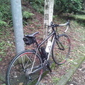
- TREK Domane 4.3
- View other bikes
ちょうつがい
(
Male /
Japan )
2013年6月30日、ロードバイク・デビュー。
0
0

 nagisa男子
GPX export
Are you sure you want to export GPX data for this trip?
![]()
![]()