![]()
![]()
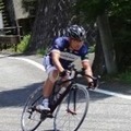
明神峠 ![]()
2015/04/11 12:16 - 14:54 / Japan 小山町
![]()
| Total distance: | 33.77 | km | Trip time: | 2:37'50 | Average speed: | 16.5 | km/h | |
|---|---|---|---|---|---|---|---|---|
| Ascending altitude: | 1417 | m | Elapsed time: | 1:55'05 | Total calories: | 831 | kcal |
| Split time | 00:01’08 | |
|---|---|---|
| Lap time | 00:01’08 | |
| Trip lap distance | 10.11 | km |
| Average | Maximum | |||
|---|---|---|---|---|
| Lap speed | 10.3 | km/h | 25 | km/h |
| Lap heart rate | 138.5 | bpm | 163 | bpm |
| Lap cadence | 50.1 | rpm | 87.5 | rpm |
明神峠
- Japan・小山町 2015/04/11 12:16 - 14:54
-
[Trip time] 2:37'50
[Total distance] 33.77km
[Average speed] 16.5km/h [Ascending altitude] 1417m [Total calories] 831kcal
[Tags] Bicycle, Road bike, Hill climb
激坂、18%の交通標識2か所、平均勾配が10%以上
標高1000m以上で雲中に入り、三国峠越えをあきらめた。


-
- RIS9
- View other bikes
sugit
(
Male /
Japan )
回した分だけ強くなる!
0
0

 しゅう
しゅうGPX export
Are you sure you want to export GPX data for this trip?
![]()
![]()