![]()
![]()
2015/04/29 桝本さんpresents ![]()
2015/04/29 05:10 - 16:17 / Japan 岡山・総社・高梁・吹屋・成羽・矢掛
![]()
| Total distance: | 168.08 | km | Trip time: | 11:06'57 | Average speed: | 21.7 | km/h | |
|---|---|---|---|---|---|---|---|---|
| Ascending altitude: | 2973 | m | Elapsed time: | 7:22'38 | Total calories: | 2912 | kcal |
| Split time | 00:01’08 | |
|---|---|---|
| Lap time | 00:01’08 | |
| Trip lap distance | 10.11 | km |
| Average | Maximum | |||
|---|---|---|---|---|
| Lap speed | 10.3 | km/h | 25 | km/h |
| Lap heart rate | 138.5 | bpm | 163 | bpm |
| Lap cadence | 50.1 | rpm | 87.5 | rpm |
2015/04/29 桝本さんpresents
- Japan・岡山・総社・高梁・吹屋・成羽・矢掛 2015/04/29 05:10 - 16:17
-
[Trip time] 11:06'57
[Total distance] 168.08km
[Average speed] 21.7km/h [Ascending altitude] 2973m [Total calories] 2912kcal
[Tags] Road bike, Training, Mountain
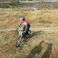
TEAM-Natural 桝本さんの企画で、総社のサンロード吉備路発着で高梁のヒルクライムコース+で130㎞ぐらいのコースを!
今まで130~135㎞ぐらいしか走った事ないので自走で。
メーターのバッテリーが切れて168㎞になってるけど、自宅近くで190㎞、距離を大台突破目的で金甲山。
最終的には218㎞で過去の総走行距離を100㎞近く更新!
もう出来んじゃろうな…
Team-Natural やまうち
(
Male /
Japan )
0
0

 T.Yamakawa
GPX export
Are you sure you want to export GPX data for this trip?
![]()
![]()