![]()
![]()
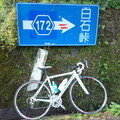
霧降高原周回 ![]()
2013/08/30 06:36 - 13:54 / Japan 栃木県
![]()
| Total distance: | 69.18 | km | Trip time: | 7:18'42 | Average speed: | 33.4 | km/h | |
|---|---|---|---|---|---|---|---|---|
| Ascending altitude: | 1577 | m | Elapsed time: | 4:18'00 | Total calories: | 729 | kcal |
| Split time | 00:01’08 | |
|---|---|---|
| Lap time | 00:01’08 | |
| Trip lap distance | 10.11 | km |
| Average | Maximum | |||
|---|---|---|---|---|
| Lap speed | 10.3 | km/h | 25 | km/h |
| Lap heart rate | 138.5 | bpm | 163 | bpm |
| Lap cadence | 50.1 | rpm | 87.5 | rpm |
霧降高原周回
- Japan・栃木県 2013/08/30 06:36 - 13:54
-
[Trip time] 7:18'42
[Total distance] 69.18km
[Average speed] 33.4km/h [Ascending altitude] 1577m [Total calories] 729kcal
[Tags]
おさむん
(
Male /
Japan )
登りが好きです。(遅いけど) 下りは嫌いです。(体重が重くて加速が良いけど)
0
0

 TURTLE_IN_THE_SHELL
GPX export
Are you sure you want to export GPX data for this trip?
![]()
![]()