![]()
![]()
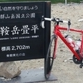
長野、松本 ![]()
2015/08/13 05:44 - 09:09 / Japan 長野県松本市
![]()
| Total distance: | 49.76 | km | Trip time: | 3:24'54 | Average speed: | 23.2 | km/h | |
|---|---|---|---|---|---|---|---|---|
| Ascending altitude: | 209 | m | Elapsed time: | 2:33'13 | Total calories: | 789 | kcal |
長野、松本
- Japan・長野県松本市 2015/08/13 05:44 - 09:09
-
[Trip time] 3:24'54
[Total distance] 49.76km
[Average speed] 23.2km/h [Ascending altitude] 209m [Total calories] 789kcal
[Tags] Road bike


-
- ÉmondaSL6
- View other bikes
ラルト
(
Male /
Japan )
山メインで攻めてます。が、そんなに速くはないです(笑) 20代後半の愛知県民
0
0

 helicon
GPX export
Are you sure you want to export GPX data for this trip?
![]()
![]()