![]()
![]()
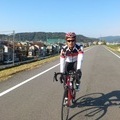
りんくうタウン マーブルビーチ ![]()
2013/10/18 08:29 - 12:41 / Japan 大阪府泉佐野市
![]()
| Total distance: | 66.05 | km | Trip time: | 4:11'51 | Average speed: | 19.5 | km/h | |
|---|---|---|---|---|---|---|---|---|
| Ascending altitude: | 333 | m | Descending altitude: | 337 | m | Total calories: | 1257 | kcal |


りんくうタウン マーブルビーチ
- Japan・大阪府泉佐野市 2013/10/18 08:29 - 12:41
-
[Trip time] 4:11'51
[Total distance] 66.05km
[Average speed] 19.5km/h [Ascending altitude] 333m [Descending altitude] 337m
[Total calories] 1257kcal
[Tags] Road bike, Long touring
りんくうタウンまで自走で行ってみました。白大理石で埋め尽くされた海岸「マーブルビーチ」は見応えがあります。


-
- GIANT TCR1 2012
- View other bikes
A.S
(
Male /
Japan )
0
1

 はたはた
はたはた

GPX export
Are you sure you want to export GPX data for this trip?
![]()
![]()