![]()
![]()
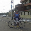
,猫峠ヒルクライム(前半) ![]()
2012/03/10 09:04 - 12:10 / Japan 福岡県力丸ダム周辺
![]()
| Total distance: | 42.28 | km | Trip time: | 3:05'44 | Average speed: | 17.1 | km/h | |
|---|---|---|---|---|---|---|---|---|
| Ascending altitude: | 594 | m | Descending altitude: | 466 | m | Total calories: | 751 | kcal |


,猫峠ヒルクライム(前半)
- Japan・福岡県力丸ダム周辺 2012/03/10 09:04 - 12:10
-
[Trip time] 3:05'44
[Total distance] 42.28km
[Average speed] 17.1km/h [Ascending altitude] 594m [Descending altitude] 466m
[Total calories] 751kcal
[Tags] Road bike, Hill climb


-
- オペラ
- View other bikes
自転車君
(
Male /
Japan )
はじめまして、福岡在住の自転車君と良います。 自分は見知らぬ土地やロングツーリングが大好きな親父です。 走ったコースを紹介していきたいと思いますので宜しくお願いします。
0
0

 くりぼー
くりぼーGPX export
Are you sure you want to export GPX data for this trip?
![]()
![]()