![]()
![]()
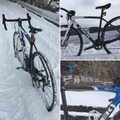
有賀峠 辰野→諏訪 ![]()
2016/05/22 13:56 - 14:53 / Not set
![]()
| Total distance: | 20.65 | km | Trip time: | 0:56'27 | Average speed: | 24.2 | km/h | |
|---|---|---|---|---|---|---|---|---|
| Ascending altitude: | 277 | m | Elapsed time: | 0:51'04 | Total calories: | 400 | kcal |
有賀峠 辰野→諏訪
- Not set・ 2016/05/22 13:56 - 14:53
-
[Trip time] 0:56'27
[Total distance] 20.65km
[Average speed] 24.2km/h [Ascending altitude] 277m [Total calories] 400kcal
[Tags]
Tsubasa
(
Male /
Japan )
0
0

 Moto56v
GPX export
Are you sure you want to export GPX data for this trip?
![]()
![]()