![]()
![]()
SCGF ![]()
2016/07/03 07:18 - 16:46 / Not set
![]()
| Total distance: | 98.29 | km | Trip time: | 9:28'00 | Average speed: | 18.6 | km/h | |
|---|---|---|---|---|---|---|---|---|
| Ascending altitude: | 1767 | m | Elapsed time: | 5:30'48 | Total calories: | 2689 | kcal |
SCGF
- Not set・ 2016/07/03 07:18 - 16:46
-
[Trip time] 9:28'00
[Total distance] 98.29km
[Average speed] 18.6km/h [Ascending altitude] 1767m [Total calories] 2689kcal
[Tags]


-
- TREK EmondaSL5
- View other bikes
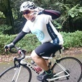
さーりゃん
(
Male /
Japan )
福岡市をメインに、ショップイベントに参加してます。 たまにツール・ド・しものせきなどのイベントにも参加してます。 まだまだスポーツバイク自体が一年ちょっとなので、 まずは脱ビギナーを目指します。
0
0

 ほげほげ
ほげほげGPX export
Are you sure you want to export GPX data for this trip?
![]()
![]()