![]()
![]()
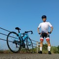
真昼の峰山 ![]()
2017/08/20 11:38 - 12:15 / Japan 高松市内
![]()
| Total distance: | 11.33 | km | Trip time: | 0:37'40 | Average speed: | 22.5 | km/h | |
|---|---|---|---|---|---|---|---|---|
| Ascending altitude: | 269 | m | Elapsed time: | 0:30'37 | Total calories: | 204 | kcal |
真昼の峰山
- Japan・高松市内 2017/08/20 11:38 - 12:15
-
[Trip time] 0:37'40
[Total distance] 11.33km
[Average speed] 22.5km/h [Ascending altitude] 269m [Elapsed time] 0:30'37
[Total calories] 204kcal
[Tags]


-
- Emonda SL6
2016年10月12日(水)納車
View other bikes
tacobose
(
Male /
Japan )
ロード:Emonda SL6 & TREK1.5 & ALTERNA FLAT乗りです。 エントリーモデルを乗り継ぎ、ミドルクラスのEmonda SL6に乗り換えました。
0
0

 Bamboo
GPX export
Are you sure you want to export GPX data for this trip?
![]()
![]()