![]()
![]()
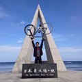
堺浜 ![]()
2014/10/14 04:29 - 06:35 / Japan 大阪 堺浜
![]()
| Total distance: | 47.6 | km | Trip time: | 2:05'16 | Average speed: | 24.7 | km/h | |
|---|---|---|---|---|---|---|---|---|
| Ascending altitude: | 449 | m | Elapsed time: | 1:53'39 | Total calories: | 737 | kcal |
| Split time | 00:01’08 | |
|---|---|---|
| Lap time | 00:01’08 | |
| Trip lap distance | 10.11 | km |
| Average | Maximum | |||
|---|---|---|---|---|
| Lap speed | 10.3 | km/h | 25 | km/h |
| Lap heart rate | 138.5 | bpm | 163 | bpm |
| Lap cadence | 50.1 | rpm | 87.5 | rpm |
堺浜
- Japan・大阪 堺浜 2014/10/14 04:29 - 06:35
-
[Trip time] 2:05'16
[Total distance] 47.6km
[Average speed] 24.7km/h [Ascending altitude] 449m [Total calories] 737kcal
[Tags] Fixie, Single-speed
1周9分


-
- leaderbike-KAGERO
- View other bikes
takumu
(
Male /
Japan )
ピストで日本縦断「鹿児島(佐多岬)~北海道(宗谷岬)」走破!!!!
0
0

 はたはた
はたはた
GPX export
Are you sure you want to export GPX data for this trip?
![]()
![]()