![]()
![]()
栃木市~佐野市 三峰山付近 ![]()
2012/09/17 11:36 - 17:47 / Japan 栃木県
![]()
| Total distance: | 88.15 | km | Trip time: | 6:11'04 | Average speed: | 15.6 | km/h | |
|---|---|---|---|---|---|---|---|---|
| Ascending altitude: | 371 | m | Descending altitude: | 374 | m | Total calories: | 950 | kcal |


栃木市~佐野市 三峰山付近
- Japan・栃木県 2012/09/17 11:36 - 17:47
-
[Trip time] 6:11'04
[Total distance] 88.15km
[Average speed] 15.6km/h [Ascending altitude] 371m [Descending altitude] 374m
[Total calories] 950kcal
[Tags] City bike, Long touring, Mountain
総距離104km
ママチャリでの最高記録です。途中雷が鳴るし、雨にも降られて最悪でした・・・


-
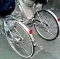
- MIyata シティサイクル(ママチャリ)
主に街乗りなどに使っていて、これで100km走ることもある相棒です。INOUで撮影する時は、いちいちブラケットから本体を外してやるので面倒です・・・
View other bikes
black
(
Male /
Japan )
主に埼玉県、栃木県を中心に走ってます。 現在は中津川林道を登り長野に行きたいですが、MTBを持っていないので現状ではきついです。次に買うとしたら、MTBかシクロクロスバイクです。
0
1

 hitotonoya5
GPX export
Are you sure you want to export GPX data for this trip?
![]()
![]()