![]()
![]()
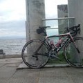
木曽川-津屋川-木曽三川公園 ![]()
2012/09/22 07:27 - 10:48 / Japan 愛知
![]()
| Total distance: | 65.16 | km | Trip time: | 3:20'49 | Average speed: | 19.8 | km/h | |
|---|---|---|---|---|---|---|---|---|
| Ascending altitude: | 72 | m | Descending altitude: | 76 | m | Total calories: | 1217 | kcal |


木曽川-津屋川-木曽三川公園
- Japan・愛知 2012/09/22 07:27 - 10:48
-
[Trip time] 3:20'49
[Total distance] 65.16km
[Average speed] 19.8km/h [Ascending altitude] 72m [Descending altitude] 76m
[Total calories] 1217kcal
[Tags] Road bike
木曽川堤防-道の駅クレール平田-津屋川堤防-木曽三川公園
サイクリング


-
- KUOTA KEBEL
2011年秋に始めたロードバイク 気ままに走ったサイクリング記録
View other bikes
kebezou
(
Male /
Japan )
2011年秋にロードバイクを購入した初心者ローディーです。 気ままに走ったポタリング記録です。
1
1

 Nakajima kohei
GPX export
Are you sure you want to export GPX data for this trip?
![]()
![]()