![]()
![]()
金丸山(野田山健康緑地公園) ![]()
2014/05/10 06:13 - 12:42 / Japan 静岡県
![]()
| Total distance: | 81.36 | km | Trip time: | 6:28'42 | Average speed: | 19.1 | km/h | |
|---|---|---|---|---|---|---|---|---|
| Ascending altitude: | 937 | m | Descending altitude: | 918 | m | Total calories: | 1298 | kcal |


金丸山(野田山健康緑地公園)
- Japan・静岡県 2014/05/10 06:13 - 12:42
-
[Trip time] 6:28'42
[Total distance] 81.36km
[Average speed] 19.1km/h [Ascending altitude] 937m [Descending altitude] 918m
[Total calories] 1298kcal
[Tags] Bicycle
金丸山目指し 6時過ぎスタート 由比東山寺から善福寺へ
途中相も変わらずの通行止めの看板 自転車の特権で脇を抜け
善福寺の少し上へ ここから上り始める 約30分で広場へ
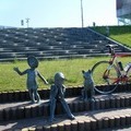
先客はキャンプの家族一組 5分ほど休憩し富士川へ下る
名物小饅頭を5箱買いザックに詰めて帰路へ
得意先と職場へ土産に配って セノバ経由で帰着


-
- ピナレロFP3
- View other bikes
カーム
(
Japan )
0
0

 ossmt64
GPX export
Are you sure you want to export GPX data for this trip?
![]()
![]()