![]()
![]()
大芦高原ヒルクライム ![]()
2014/11/22 08:20 - 2014/11/24 10:04 / Japan 美作市・和気
![]()
| Total distance: | 49.25 | km | Trip time: | 49:44'24 | Average speed: | 18.8 | km/h | |
|---|---|---|---|---|---|---|---|---|
| Ascending altitude: | 902 | m | Elapsed time: | 2:21'25 | Total calories: | 1167 | kcal |
| Split time | 00:01’08 | |
|---|---|---|
| Lap time | 00:01’08 | |
| Trip lap distance | 10.11 | km |
| Average | Maximum | |||
|---|---|---|---|---|
| Lap speed | 10.3 | km/h | 25 | km/h |
| Lap heart rate | 138.5 | bpm | 163 | bpm |
| Lap cadence | 50.1 | rpm | 87.5 | rpm |
大芦高原ヒルクライム
- Japan・美作市・和気 2014/11/22 08:20 - 2014/11/24 10:04
-
[Trip time] 49:44'24
[Total distance] 49.25km
[Average speed] 18.8km/h [Ascending altitude] 902m [Total calories] 1167kcal
[Tags]


-
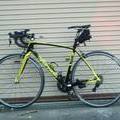
- アンカーRL8
- View other bikes
綱嶋一真
(
Male /
Japan )
0
0

 つーさん
つーさんGPX export
Are you sure you want to export GPX data for this trip?
![]()
![]()