![]()
![]()
伊吹山ドライブウェイダウンヒル ![]()
2016/04/10 12:07 - 13:53 / Japan 岐阜県・滋賀県
![]()
| Total distance: | 19.2 | km | Trip time: | 1:46'21 | Average speed: | 22.4 | km/h | |
|---|---|---|---|---|---|---|---|---|
| Ascending altitude: | 70 | m | Elapsed time: | 0:45'07 | Total calories: | 409 | kcal |
| Split time | 00:01’08 | |
|---|---|---|
| Lap time | 00:01’08 | |
| Trip lap distance | 10.11 | km |
| Average | Maximum | |||
|---|---|---|---|---|
| Lap speed | 10.3 | km/h | 25 | km/h |
| Lap heart rate | 138.5 | bpm | 163 | bpm |
| Lap cadence | 50.1 | rpm | 87.5 | rpm |
伊吹山ドライブウェイダウンヒル
- Japan・岐阜県・滋賀県 2016/04/10 12:07 - 13:53
-
[Trip time] 1:46'21
[Total distance] 19.2km
[Average speed] 22.4km/h [Ascending altitude] 70m [Total calories] 409kcal
[Tags] Road bike, Race, Hill climb
伊吹山ドライブウェイヒルクライムのダウンヒル版。
フルコース15キロのダウンヒルは壮快で寒かった・・・。
でも登って来た甲斐がありました。


-
- cannondale CAAD12
- View other bikes
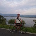
はたはた
(
Male /
Japan )
2013年の夏、バイクをKLEINのクロスバイク改造ロードからANCHOR RNC7に組み替えて、本格ロードデビューをします。 これを機にサイコンもSTEALTH10に変えました。今まではスマホのアプリでバッテリー残量を気にしながら、走行ログを取ってましたが、これからはその呪縛からも解放され快適に走れそうです。 今は主に愛知県の野山を駆け巡ってますが、RNC7に慣れたらクルマに積んで遠征もしてみたいです。 どうぞよろしくお願いします。
0
0

 ObaQ
ObaQGPX export
Are you sure you want to export GPX data for this trip?
![]()
![]()