![]()
![]()
フルアワイチ ![]()
2016/04/10 08:39 - 17:33 / Japan 淡路島
![]()
| Total distance: | 143.01 | km | Trip time: | 8:54'31 | Average speed: | 25.6 | km/h | |
|---|---|---|---|---|---|---|---|---|
| Ascending altitude: | 1506 | m | Elapsed time: | 5:56'40 | Total calories: | 3123 | kcal |
フルアワイチ
- Japan・淡路島 2016/04/10 08:39 - 17:33
-
[Trip time] 8:54'31
[Total distance] 143.01km
[Average speed] 25.6km/h [Ascending altitude] 1506m [Total calories] 3123kcal
[Tags] Road bike
残り数キロでスマホ電池切れ


-
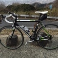
- CAAD8
- View other bikes
Shin
(
Male /
Japan )
2015年11月からロードバイク(CAAD8)初めました。 生駒・信貴山系の峠、淀川、木津川、桂川CR辺りに出没します。 お近くの方、声かけてやってください。
0
0

 HFC19
HFC19GPX export
Are you sure you want to export GPX data for this trip?
![]()
![]()