![]()
![]()
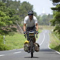
マイアミ浜キャンプ場ー京都伏見 ![]()
2016/05/05 06:52 - 09:44 / Japan 滋賀県・京都府
![]()
| Total distance: | 26.21 | km | Trip time: | 2:52'27 | Average speed: | 12.7 | km/h | |
|---|---|---|---|---|---|---|---|---|
| Ascending altitude: | 799 | m | Elapsed time: | 2:06'35 | Total calories: | 285 | kcal |
マイアミ浜キャンプ場ー京都伏見
- Japan・滋賀県・京都府 2016/05/05 06:52 - 09:44
-
[Trip time] 2:52'27
[Total distance] 26.21km
[Average speed] 12.7km/h [Ascending altitude] 799m [Elapsed time] 2:06'35
[Total calories] 285kcal
[Tags] Touring bike, Long touring
電池切れで三千院以降のデータがない


-
- パナモリランドナー
PanasonicのFSS5で組んだツーリング用バイク
View other bikes
ちゃりだー
(
Male /
Japan )
キャンプツーリング専門
0
0

 MAC
MAC
GPX export
Are you sure you want to export GPX data for this trip?
![]()
![]()