![]()
![]()
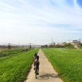
滝畑ダム往路 2016/05/08 ![]()
2016/05/08 07:01 - 11:35 / Not set
![]()
| Total distance: | 46.7 | km | Trip time: | 4:34'13 | Average speed: | 18.1 | km/h | |
|---|---|---|---|---|---|---|---|---|
| Ascending altitude: | 370 | m | Elapsed time: | 2:35'56 | Total calories: | 550 | kcal |
滝畑ダム往路 2016/05/08
- Not set・ 2016/05/08 07:01 - 11:35
-
[Trip time] 4:34'13
[Total distance] 46.7km
[Average speed] 18.1km/h [Ascending altitude] 370m [Total calories] 550kcal
[Tags]


-
- Giant TCR0
- View other bikes
purin
(
Male /
Japan )
0
0

 Ue
UeGPX export
Are you sure you want to export GPX data for this trip?
![]()
![]()