![]()
![]()
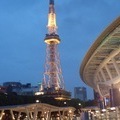
浜松~岡崎 ![]()
2016/05/18 06:31 - 14:24 / Japan 浜松~岡崎
![]()
| Total distance: | 96.52 | km | Trip time: | 7:53'35 | Average speed: | 20.9 | km/h | |
|---|---|---|---|---|---|---|---|---|
| Ascending altitude: | 557 | m | Elapsed time: | 4:41'11 | Total calories: | 2221 | kcal |
浜松~岡崎
- Japan・浜松~岡崎 2016/05/18 06:31 - 14:24
-
[Trip time] 7:53'35
[Total distance] 96.52km
[Average speed] 20.9km/h [Ascending altitude] 557m [Total calories] 2221kcal
[Tags] Road bike, Spring, Sunny
岡崎城
大樹寺
慈英@激熱
(
Male /
Japan )
0
0

 メイプルリーフス
GPX export
Are you sure you want to export GPX data for this trip?
![]()
![]()