![]()
![]()
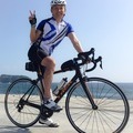
2016アルプス安曇野センチュリーライド ![]()
2016/05/22 08:12 - 15:32 / Japan 長野県
![]()
| Total distance: | 119.34 | km | Trip time: | 7:20'26 | Average speed: | 22.8 | km/h | |
|---|---|---|---|---|---|---|---|---|
| Ascending altitude: | 934 | m | Elapsed time: | 5:23'41 | Total calories: | 2387 | kcal |
2016アルプス安曇野センチュリーライド
- Japan・長野県 2016/05/22 08:12 - 15:32
-
[Trip time] 7:20'26
[Total distance] 119.34km
[Average speed] 22.8km/h [Ascending altitude] 934m [Total calories] 2387kcal
[Tags]


-
- TREK Emonda S5
- View other bikes
ロビン
(
Male /
Japan )
0
0

 MIYA_SITCC
GPX export
Are you sure you want to export GPX data for this trip?
![]()
![]()