![]()
![]()
Mt富士ヒルクライム(上り) ![]()
2016/06/12 08:28 - 10:17 / Japan 富士スバルライン
![]()
| Total distance: | 23.98 | km | Trip time: | 1:49'05 | Average speed: | 13.2 | km/h | |
|---|---|---|---|---|---|---|---|---|
| Ascending altitude: | 941 | m | Elapsed time: | 1:49'05 | Total calories: | 208 | kcal |
Mt富士ヒルクライム(上り)
- Japan・富士スバルライン 2016/06/12 08:28 - 10:17
-
[Trip time] 1:49'05
[Total distance] 23.98km
[Average speed] 13.2km/h [Ascending altitude] 941m [Total calories] 208kcal
[Tags] Road bike, Race, Morning


-
- Bianchi Via Nirone7 (105 11s)2015
2015年発売のBianchi Via Nirone7です。 海外販売限定(文字がグレー)モデル。 コンポーネントは105、11速で統一しています。
View other bikes
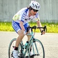
りょう
(
Male /
Japan )
神奈川・東京間の通勤にロードバイクを利用しています。 その他、エンデューロやヒルクライムなどにも参加しています。 今後の目標としては、ロングライド、東京大阪間のキャノンボールを実施したいと思っております。 弱虫ペダルに影響されはじめましたので、弱虫ペダルが好きな方、お気軽にお声がけください。 また、ブログもやっています。 ご興味ある方はご覧頂ければ幸いです。 http://ameblo.jp/arakita-ryo
0
0

 tora
tora

GPX export
Are you sure you want to export GPX data for this trip?
![]()
![]()