![]()
![]()
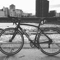
豊平川河川敷 2016/7/11 夕方 ![]()
2016/07/11 18:48 - 19:30 / Japan 札幌
![]()
| Total distance: | 17.31 | km | Trip time: | 0:41'32 | Average speed: | 25.1 | km/h | |
|---|---|---|---|---|---|---|---|---|
| Ascending altitude: | 78 | m | Elapsed time: | 0:41'32 | Total calories: | 269 | kcal |
豊平川河川敷 2016/7/11 夕方
- Japan・札幌 2016/07/11 18:48 - 19:30
-
[Trip time] 0:41'32
[Total distance] 17.31km
[Average speed] 25.1km/h [Ascending altitude] 78m [Total calories] 269kcal
[Tags]


-
- ANCHOR RFA3 EX
- View other bikes
K
(
Male /
Japan )
ホームは、豊平川河川敷。
0
0

 hokuto6138
GPX export
Are you sure you want to export GPX data for this trip?
![]()
![]()