![]()
![]()
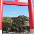
松郷峠~初級ヒルクライム~ ![]()
2016/07/16 07:37 - 14:06 / Japan ときがわ町
![]()
| Total distance: | 50.52 | km | Trip time: | 6:29'27 | Average speed: | 19.3 | km/h | |
|---|---|---|---|---|---|---|---|---|
| Ascending altitude: | 886 | m | Elapsed time: | 3:05'14 | Total calories: | 1298 | kcal |
松郷峠~初級ヒルクライム~
- Japan・ときがわ町 2016/07/16 07:37 - 14:06
-
[Trip time] 6:29'27
[Total distance] 50.52km
[Average speed] 19.3km/h [Ascending altitude] 886m [Total calories] 1298kcal
[Tags] Road bike


-
- ビアンキ センプレ
- View other bikes
kado-P
(
Male /
Japan )
貧脚、初心者
0
0

 ともかず♂
ともかず♂GPX export
Are you sure you want to export GPX data for this trip?
![]()
![]()