![]()
![]()
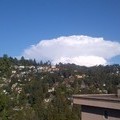
Grizzly Skyline ![]()
2016/07/02 08:49 - 10:23 / USA Oakland
![]()
| Total distance: | 34.07 | km | Trip time: | 1:33'53 | Average speed: | 22.7 | km/h | |
|---|---|---|---|---|---|---|---|---|
| Ascending altitude: | 689 | m | Elapsed time: | 1:26'56 | Total calories: | 599 | kcal |
| Split time | 00:01’08 | |
|---|---|---|
| Lap time | 00:01’08 | |
| Trip lap distance | 10.11 | km |
| Average | Maximum | |||
|---|---|---|---|---|
| Lap speed | 10.3 | km/h | 25 | km/h |
| Lap heart rate | 138.5 | bpm | 163 | bpm |
| Lap cadence | 50.1 | rpm | 87.5 | rpm |
Grizzly Skyline
- USA・Oakland 2016/07/02 08:49 - 10:23
-
[Trip time] 1:33'53
[Total distance] 34.07km
[Average speed] 22.7km/h [Ascending altitude] 689m [Total calories] 599kcal
[Tags]
Out and back on Skyline and Grizzly


-
- Ed Litton
- View other bikes
SnortinRidge
(
USA )
0
0

 Hakgoto
GPX export
Are you sure you want to export GPX data for this trip?
![]()
![]()