![]()
![]()
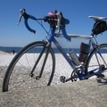
夜ポタージュ ![]()
2016/08/12 19:46 - 21:46 / Not set
![]()
| Total distance: | 32.32 | km | Trip time: | 1:59'35 | Average speed: | 24 | km/h | |
|---|---|---|---|---|---|---|---|---|
| Ascending altitude: | 768 | m | Elapsed time: | 1:22'38 | Total calories: | 470 | kcal |
夜ポタージュ
- Not set・ 2016/08/12 19:46 - 21:46
-
[Trip time] 1:59'35
[Total distance] 32.32km
[Average speed] 24km/h [Ascending altitude] 768m [Total calories] 470kcal
[Tags]


-
- コルナー
- View other bikes
snowcat
(
Male /
Japan )
大阪中心にぽたぽたりんぐ
0
0

 Koichi
GPX export
Are you sure you want to export GPX data for this trip?
![]()
![]()