![]()
![]()
旭川市~天人峡(上り) ![]()
2012/05/20 08:05 - 11:20 / Japan 天人峡
![]()
| Total distance: | 50.96 | km | Trip time: | 3:14'57 | Average speed: | 18.1 | km/h | |
|---|---|---|---|---|---|---|---|---|
| Ascending altitude: | 573 | m | Descending altitude: | 77 | m | Total calories: | 726 | kcal |


旭川市~天人峡(上り)
- Japan・天人峡 2012/05/20 08:05 - 11:20
-
[Trip time] 3:14'57
[Total distance] 50.96km
[Average speed] 18.1km/h [Ascending altitude] 573m [Descending altitude] 77m
[Total calories] 726kcal
[Tags] Road bike, Recreation, Training
今日は、天気も良く気持ちよかったです!途中色々寄り道&大雪山国立公園、忠別ダム&天人峡・・・景色満喫しながら、走ってきました(^^)


-
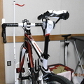
- 2012 KUOTA KHARMA (その1)
お初のカーボンロード、一番のお気に入りです・・・^Q^ シーズン初めの調整前ですぅ~
View other bikes
kaba3
(
Male /
Japan )
KUOTA ロードバイク大好きです(^Q^) 自転車に乗るだけでなく、いじくるのも好きです。 冬期は、MTBスノーライド楽しんでいます! ブルベBRM(200~600km)を主に楽しんでいます。 ★2013年度 AJ北海道ブルベ★ 1.BRM505 北海道200km十勝 (完走) 2.BRM609 北海道300km留萌 (完走) 3.BRM629 北海道400km雄武 (参加できず) 4.BRM803 北海道600km大雪 (完走) 5.BRM907 北海道400km本桐 (完走) 6.BRM1006 北海道200km大夕張 (完走) AJ北海道HP(イベント情報&リザルト)などは→ http://sappwind.sakura.ne.jp/index.html
0
2

 keian_ja8dni
GPX export
Are you sure you want to export GPX data for this trip?
![]()
![]()