![]()
![]()
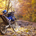
2016マウンテンサイクリング乗鞍 ![]()
2016/08/28 07:20 - 09:14 / Japan 乗鞍
![]()
| Total distance: | 20.57 | km | Trip time: | 1:54'02 | Average speed: | 10.8 | km/h | |
|---|---|---|---|---|---|---|---|---|
| Ascending altitude: | 1297 | m | Elapsed time: | 1:53'44 | Total calories: | 76 | kcal |
| Split time | 00:01’08 | |
|---|---|---|
| Lap time | 00:01’08 | |
| Trip lap distance | 10.11 | km |
| Average | Maximum | |||
|---|---|---|---|---|
| Lap speed | 10.3 | km/h | 25 | km/h |
| Lap heart rate | 138.5 | bpm | 163 | bpm |
| Lap cadence | 50.1 | rpm | 87.5 | rpm |
2016マウンテンサイクリング乗鞍
- Japan・乗鞍 2016/08/28 07:20 - 09:14
-
[Trip time] 1:54'02
[Total distance] 20.57km
[Average speed] 10.8km/h [Ascending altitude] 1297m [Total calories] 76kcal
[Tags] Bicycle, Hill climb, MTB
久々のドライコンディションと頂上ゴール。タイムは1時間52分53秒で、とうとう初めて走った15年前(練習0)とほぼ同タイムまで遅くなってしまった。ちなみにFクラス560位/791台と後ろのほう。
26インチ通勤快速MTBでの出走は今回で最後かな。


-
- SuperGo ACCESS ALU
- View other bikes
Randy
(
Male /
Japan )
http://www.a3jettaglx.com/index.html
0
0

 case25
GPX export
Are you sure you want to export GPX data for this trip?
![]()
![]()