![]()
![]()
Bonk Ride ![]()
2014/02/09 07:01 - 12:51 / Australia West Head
![]()
| Total distance: | 98.85 | km | Trip time: | 5:49'55 | Average speed: | 23.2 | km/h | |
|---|---|---|---|---|---|---|---|---|
| Ascending altitude: | 1889 | m | Elapsed time: | 4:08'13 | Total calories: | 1572 | kcal |
| Split time | 00:01’08 | |
|---|---|---|
| Lap time | 00:01’08 | |
| Trip lap distance | 10.11 | km |
| Average | Maximum | |||
|---|---|---|---|---|
| Lap speed | 10.3 | km/h | 25 | km/h |
| Lap heart rate | 138.5 | bpm | 163 | bpm |
| Lap cadence | 50.1 | rpm | 87.5 | rpm |
Bonk Ride
- Australia・West Head 2014/02/09 07:01 - 12:51
-
[Trip time] 5:49'55
[Total distance] 98.85km
[Average speed] 23.2km/h [Ascending altitude] 1889m [Total calories] 1572kcal
[Tags] Bicycle, Road bike


-
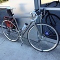
- Ultralite Ti
- View other bikes
rheicel
(
Male )
0
0

 rheicel
GPX export
Are you sure you want to export GPX data for this trip?
![]()
![]()