![]()
![]()
柳川サイクリング ![]()
2016/11/20 07:53 - 12:38 / Japan yamagata
![]()
| Total distance: | 69.87 | km | Trip time: | 4:03'42 | Average speed: | 21.4 | km/h | |
|---|---|---|---|---|---|---|---|---|
| Ascending altitude: | 803 | m | Elapsed time: | 3:35'05 | Total calories: | 245 | kcal |
| Split time | 00:01’08 | |
|---|---|---|
| Lap time | 00:01’08 | |
| Trip lap distance | 10.11 | km |
| Average | Maximum | |||
|---|---|---|---|---|
| Lap speed | 10.3 | km/h | 25 | km/h |
| Lap heart rate | 138.5 | bpm | 163 | bpm |
| Lap cadence | 50.1 | rpm | 87.5 | rpm |
柳川サイクリング
- Japan・yamagata 2016/11/20 07:53 - 12:38
-
[Trip time] 4:03'42
[Total distance] 69.87km
[Average speed] 21.4km/h [Ascending altitude] 803m [Total calories] 245kcal
[Tags]
サイクルランドさいとう様HPの文章をそのまま引用させていただきます。
AM8:30 お店集合 AM9:00 中山野球場経由(都合のいい方へどうぞ)
柳川方面40~60kmくらい。多少アップダウンはありますが平地メインです。ビギナーさんも是非どうぞ。


-
- TREK LYNC 5
SHIMANO inter11に改造
View other bikes
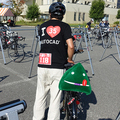
nakao
(
Male /
Japan )
トリップデータはGPSのみのデータです。 本体を持ち歩いているので、目的地での徒歩部分も データとして保存される場合があります。
0
0

 nakao
nakaoGPX export
Are you sure you want to export GPX data for this trip?
![]()
![]()