![]()
![]()
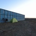
Morning Ride ![]()
2016/12/05 06:24 - 06:50 / Japan 矢掛町
![]()
| Total distance: | 4.39 | km | Trip time: | 0:26'24 | Average speed: | 13.2 | km/h | |
|---|---|---|---|---|---|---|---|---|
| Ascending altitude: | 175 | m | Elapsed time: | 0:21'45 | Total calories: | 59 | kcal |
Morning Ride
- Japan・矢掛町 2016/12/05 06:24 - 06:50
-
[Trip time] 0:26'24
[Total distance] 4.39km
[Average speed] 13.2km/h [Ascending altitude] 175m [Total calories] 59kcal
[Tags]
taka
(
Male /
Japan )
目指せクンジャラブ峠
0
0

 T.Yamakawa
GPX export
Are you sure you want to export GPX data for this trip?
![]()
![]()