![]()
![]()
greenroad ![]()
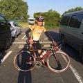
2017/01/28 08:12 - 12:08 / Japan 河内長野
![]()
| Total distance: | 51.53 | km | Trip time: | 3:56'16 | Average speed: | 22.1 | km/h | |
|---|---|---|---|---|---|---|---|---|
| Ascending altitude: | 817 | m | Elapsed time: | 2:21'53 | Total calories: | 1726 | kcal |
greenroad
- Japan・河内長野 2017/01/28 08:12 - 12:08
-
[Trip time] 3:56'16
[Total distance] 51.53km
[Average speed] 22.1km/h [Ascending altitude] 817m [Total calories] 1726kcal
[Tags]


-
- TCR
- View other bikes
tcr8484
(
Male /
Japan )
0
0

 Sin
SinGPX export
Are you sure you want to export GPX data for this trip?
![]()
![]()