![]()
![]()
"JINMUJI TAKATORIYAMA"hiking ![]()
2017/03/16 11:04 - 13:29 / Japan 逗子神武寺 横須賀鷹取山
![]()
| Total distance: | 4.92 | km | Trip time: | 2:25'15 | Average speed: | 2.8 | km/h | |
|---|---|---|---|---|---|---|---|---|
| Ascending altitude: | 349 | m | Elapsed time: | 0:47'35 | Total calories: | 25 | kcal |
| Split time | 00:01’08 | |
|---|---|---|
| Lap time | 00:01’08 | |
| Trip lap distance | 10.11 | km |
| Average | Maximum | |||
|---|---|---|---|---|
| Lap speed | 10.3 | km/h | 25 | km/h |
| Lap heart rate | 138.5 | bpm | 163 | bpm |
| Lap cadence | 50.1 | rpm | 87.5 | rpm |
"JINMUJI TAKATORIYAMA"hiking
- Japan・逗子神武寺 横須賀鷹取山 2017/03/16 11:04 - 13:29
-
[Trip time] 2:25'15
[Total distance] 4.92km
[Average speed] 2.8km/h [Ascending altitude] 349m [Total calories] 25kcal
[Tags] Other avtivity, Walking, Mountain
久々の快晴となった午前を中心に「逗子神武寺」から「横須賀追浜」に
抜ける『神武寺鷹取山ハイキングコース』を辿りました。
総歩数13,000歩。
KAGA-fukuoka
(
Male /
Japan )
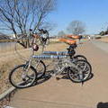
PEUGEOTフォールディング2台をスポーツバージョンに 少々改造、九州福岡の博多湾沿いや室見川河畔コース をベースに軽ポタリング等で楽しんでいました。が、 訳あってH27.8.20横浜市金沢区に転居。 八景島シーサイドパラダイス周辺を新フィールドに。
0
0

 べんちゃん
べんちゃんGPX export
Are you sure you want to export GPX data for this trip?
![]()
![]()