![]()
![]()
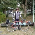
天野街道・泉北グリーンウェイ ![]()
2017/04/16 10:24 - 13:07 / Japan 大阪狭山市・堺市
![]()
| Total distance: | 22.32 | km | Trip time: | 2:42'23 | Average speed: | 11.9 | km/h | |
|---|---|---|---|---|---|---|---|---|
| Ascending altitude: | 264 | m | Descending altitude: | 275 | m | Total calories: | 243 | kcal |


天野街道・泉北グリーンウェイ
- Japan・大阪狭山市・堺市 2017/04/16 10:24 - 13:07
-
[Trip time] 2:42'23
[Total distance] 22.32km
[Average speed] 11.9km/h [Ascending altitude] 264m [Descending altitude] 275m
[Total calories] 243kcal
[Tags]
天野街道~天野山金剛寺~泉北グリーンウェイ周遊
いつものサイクリング仲間と3人で
動画作動せず


-
- KHS F20-RC special edition
- View other bikes
カツヨシ
(
Male /
Japan )
仲間とサイクリングやポタリングを楽しんでいます。 これから仲間を増やし、近畿のみならず、日本全国を走ってみたいです。
0
0

 haRachan
GPX export
Are you sure you want to export GPX data for this trip?
![]()
![]()