![]()
![]()
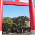
ヒルクライム~美の山~ ![]()
2017/05/07 07:27 - 18:46 / Japan 皆野町
![]()
| Total distance: | 142.56 | km | Trip time: | 11:19'08 | Average speed: | 21.7 | km/h | |
|---|---|---|---|---|---|---|---|---|
| Ascending altitude: | 2310 | m | Elapsed time: | 6:45'22 | Total calories: | 3858 | kcal |
ヒルクライム~美の山~
- Japan・皆野町 2017/05/07 07:27 - 18:46
-
[Trip time] 11:19'08
[Total distance] 142.56km
[Average speed] 21.7km/h [Ascending altitude] 2310m [Total calories] 3858kcal
[Tags] Road bike


-
- ビアンキ センプレ
- View other bikes
kado-P
(
Male /
Japan )
貧脚、初心者
0
0

 kata0320


GPX export
Are you sure you want to export GPX data for this trip?
![]()
![]()