![]()
![]()
渋峠下り ![]()
2017/05/20 14:27 - 15:30 / Japan 長野
![]()
| Total distance: | 27.43 | km | Trip time: | 1:02'30 | Average speed: | 34.1 | km/h | |
|---|---|---|---|---|---|---|---|---|
| Ascending altitude: | 29 | m | Elapsed time: | 0:49'32 | Total calories: | 793 | kcal |
渋峠下り
- Japan・長野 2017/05/20 14:27 - 15:30
-
[Trip time] 1:02'30
[Total distance] 27.43km
[Average speed] 34.1km/h [Ascending altitude] 29m [Total calories] 793kcal
[Tags]


-
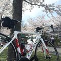
- COLNAGO C-RS
- View other bikes
んんにころ
(
Japan )
のんびりぽたぽたしながら愛車といろんなところ走ってます
0
0

 おさむん
おさむんGPX export
Are you sure you want to export GPX data for this trip?
![]()
![]()