![]()
![]()
Morning Ride ![]()
2017/06/11 09:10 - 14:05 / Not set
![]()
| Total distance: | 57.85 | km | Trip time: | 4:54'19 | Average speed: | 19.7 | km/h | |
|---|---|---|---|---|---|---|---|---|
| Ascending altitude: | 692 | m | Elapsed time: | 3:02'40 | Total calories: | 914 | kcal |
Morning Ride
- Not set・ 2017/06/11 09:10 - 14:05
-
[Trip time] 4:54'19
[Total distance] 57.85km
[Average speed] 19.7km/h [Ascending altitude] 692m [Total calories] 914kcal
[Tags]


-
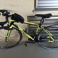
- アンカー RL8
- View other bikes
ツルテル
(
Male /
Japan )
0
0

 TT hair 宮崎
GPX export
Are you sure you want to export GPX data for this trip?
![]()
![]()