![]()
![]()
浄土平磐梯吾妻スカイライン ![]()
2017/06/11 09:46 - 14:41 / Japan 福島県浄土平
![]()
| Total distance: | 37.03 | km | Trip time: | 4:54'29 | Average speed: | 15.6 | km/h | |
|---|---|---|---|---|---|---|---|---|
| Ascending altitude: | 1556 | m | Elapsed time: | 2:19'20 | Total calories: | 1040 | kcal |
| Split time | 00:01’08 | |
|---|---|---|
| Lap time | 00:01’08 | |
| Trip lap distance | 10.11 | km |
| Average | Maximum | |||
|---|---|---|---|---|
| Lap speed | 10.3 | km/h | 25 | km/h |
| Lap heart rate | 138.5 | bpm | 163 | bpm |
| Lap cadence | 50.1 | rpm | 87.5 | rpm |
浄土平磐梯吾妻スカイライン
- Japan・福島県浄土平 2017/06/11 09:46 - 14:41
-
[Trip time] 4:54'29
[Total distance] 37.03km
[Average speed] 15.6km/h [Ascending altitude] 1556m [Total calories] 1040kcal
[Tags] Road bike


-
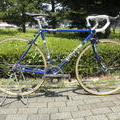
- アンカー
クライム用に使っているセカンドバイクです。
View other bikes
ビュート
(
Male /
Japan )
0
0

 coophimeko
GPX export
Are you sure you want to export GPX data for this trip?
![]()
![]()